The island of Santo Antão in Cape Verde is a hiker’s paradise. This island was for me the main reason to visit Cape Verde. Santo Antão is just spectacular; it has dramatic canyons, cloud-soaked peaks and vertigo-inspiring drops. I only spent here a couple of days, but you can easily spend here a couple of weeks. There are countless hiking trails to choose from, but as my time was limited on this stunning island I narrowed it down to the 2 most popular trails: the Cova Crater to Valé do Paúl Trail and the Coastal Track. In my previous blog post you can read about my complete trip to Cape Verde.
Cova Crater – Valé do Paúl
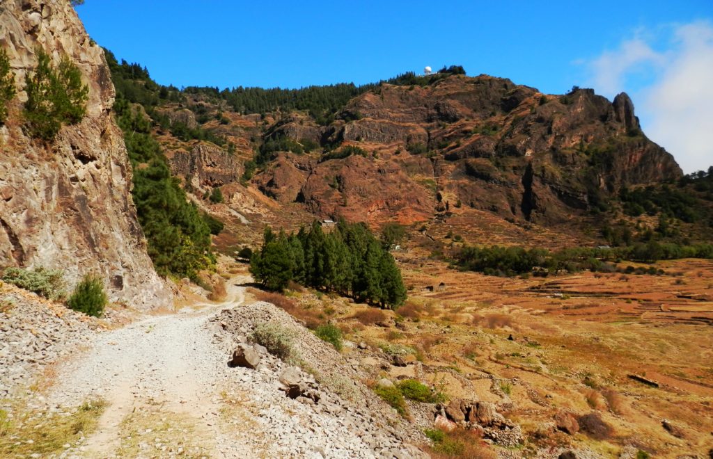
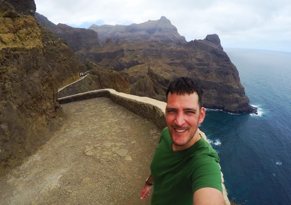
This classic hike leads from the Cova crater down to the stunning Valé do Paúl. It’s the most popular trail of the island although it felt like I was the only one hiking the trail. I took the 8am ferry from Mindelo to Santo Antão. When I got out of the ferry terminal I was overwhelmed with the amount of alugueres (shared minibuses) which were waiting for customers. Most of the alugueres take the coastal road to the villages around the island. But if you want to reach the Cova crater, which is located in the centre of the island, you need to catch an aluguer which takes the transisland road. Look for an aluguer with the name ‘Joao de Corda’ and he will drop you off near the crater from where you can start the hiking trail.
Let’s start hiking!
The beautiful Cova crater on the island of Santo Antão.
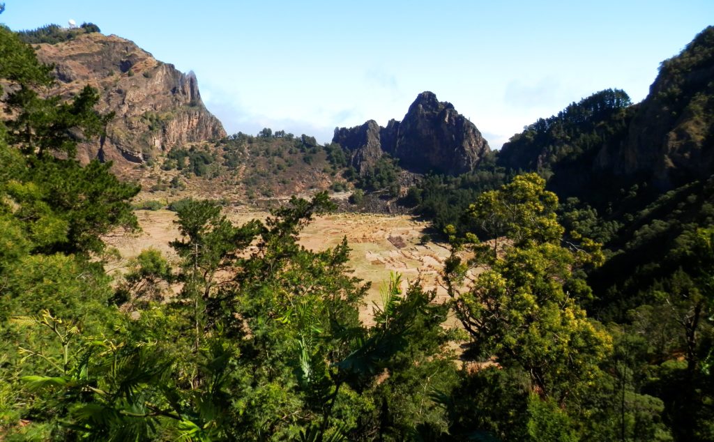
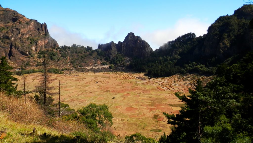
The trail starts at the stunning Cova crater. You will walk around the crater which is a fertile valley serving as farmlands for the island.
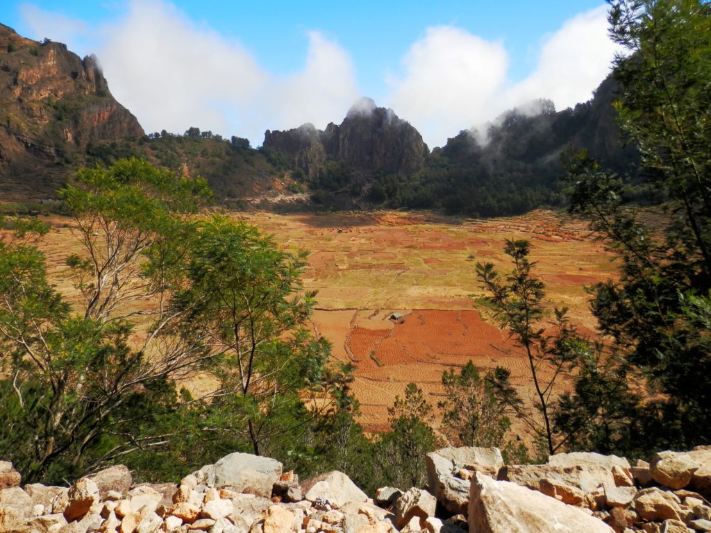
The Cova crater is full with farmlands.
The Cova crater is surrounded by rugged mountains.
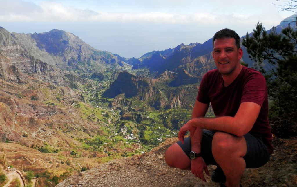
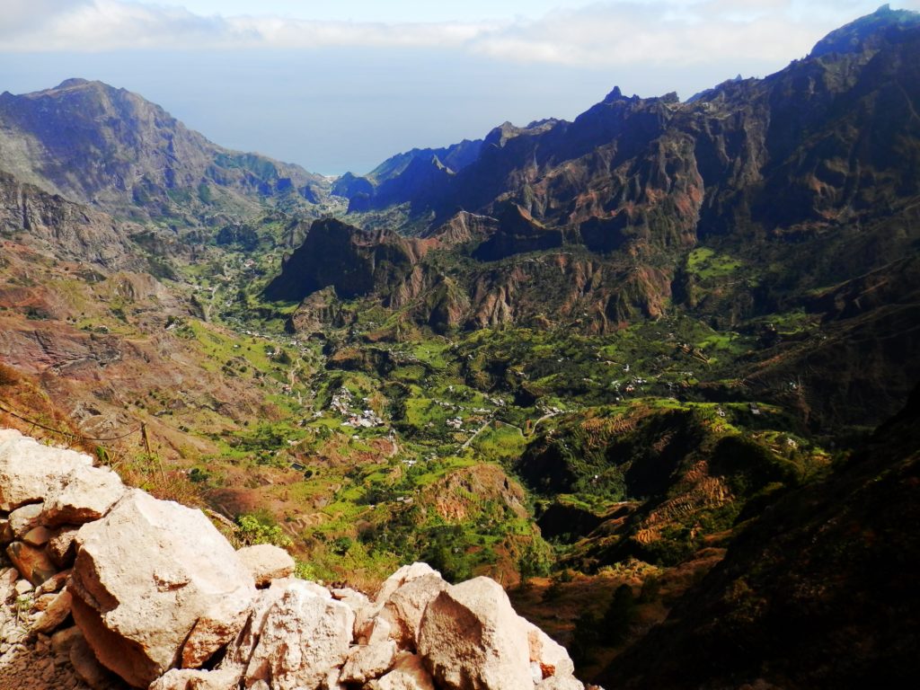
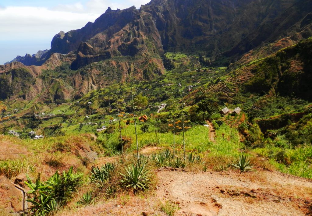
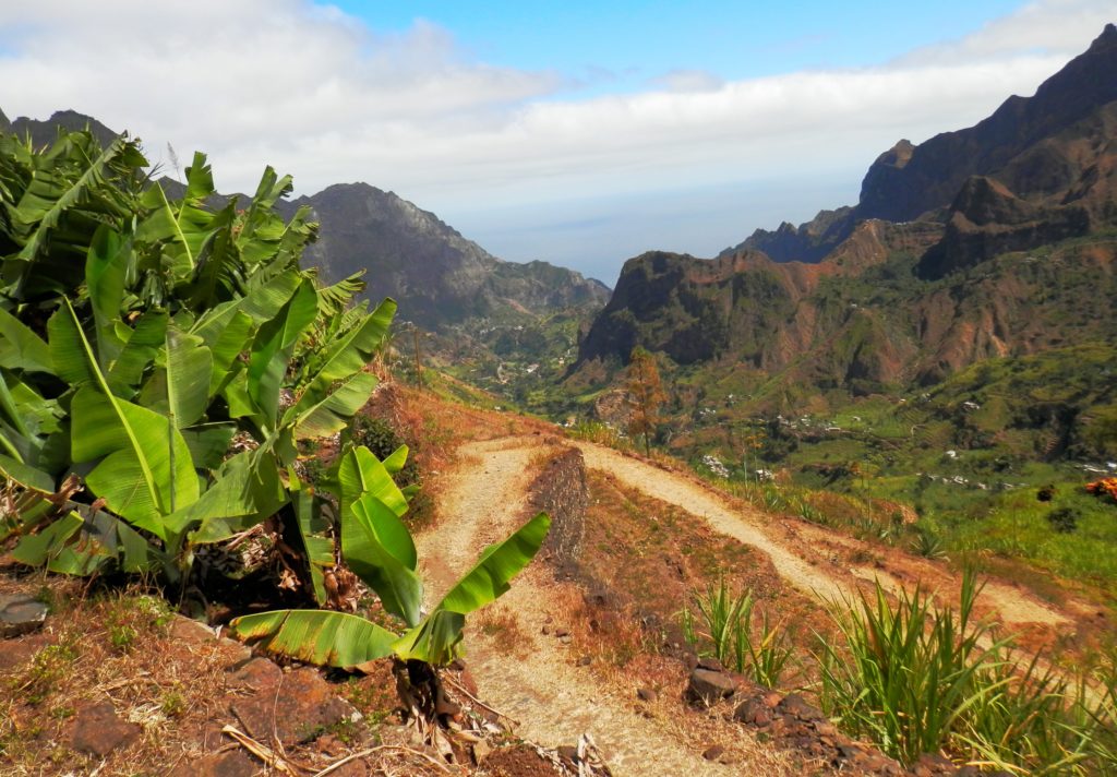
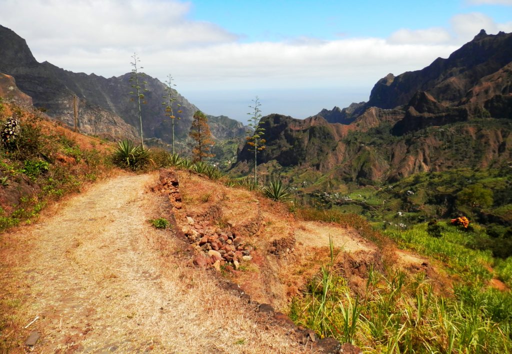
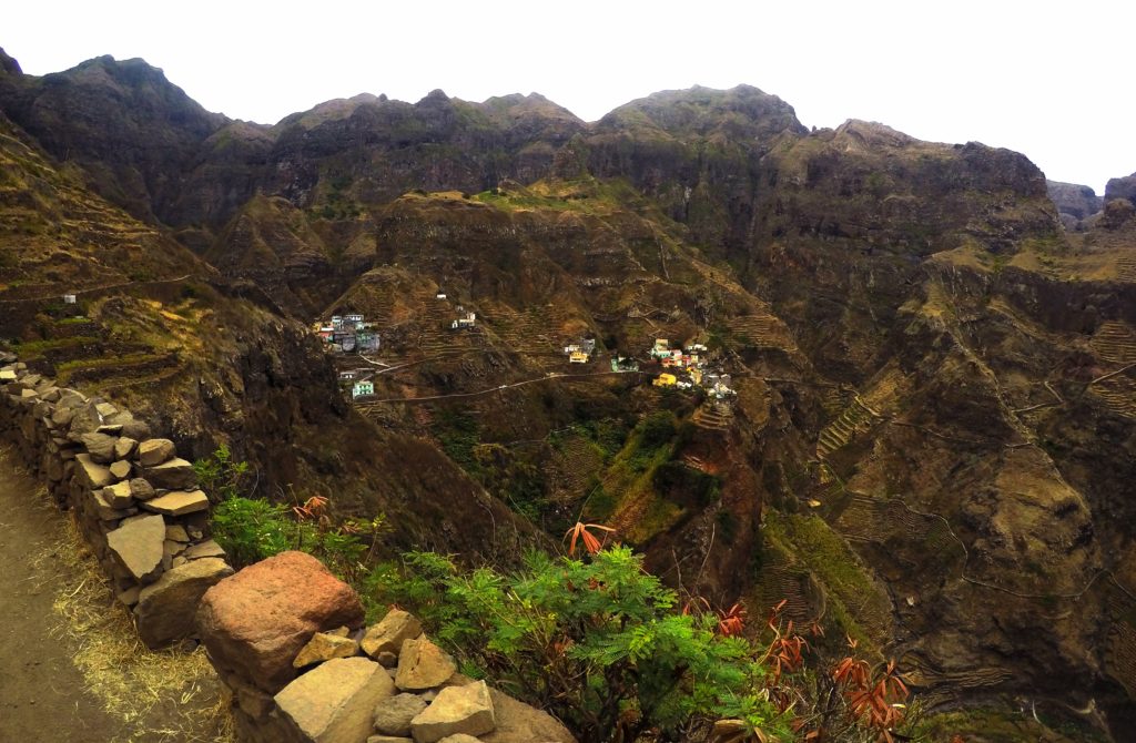
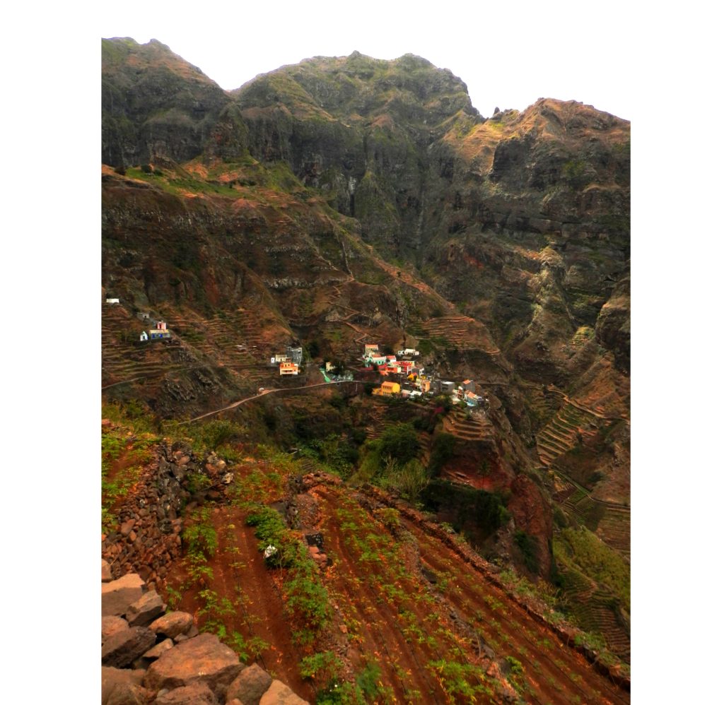
Once you reach the opposite side of the crater you have to hike a bit uphill towards a viewpoint which will take your breath away. Just…..Wow! What a view! From here you will have an amazing view of the valley of Paúl.
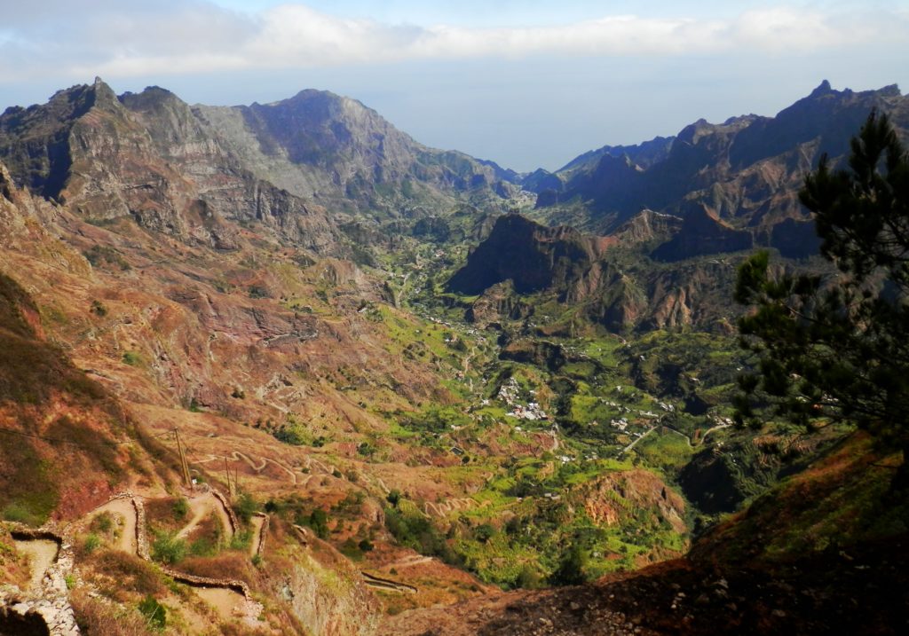
Wow! What a view into the Valé do Paúl!
Such a breathtaking view.
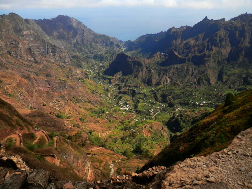
The valley of Paúl is just stunning.
You can see the ocean behind the mountain peaks and you instantly know that you will have a long walk ahead of you before you will reach the coastal village of Paúl.
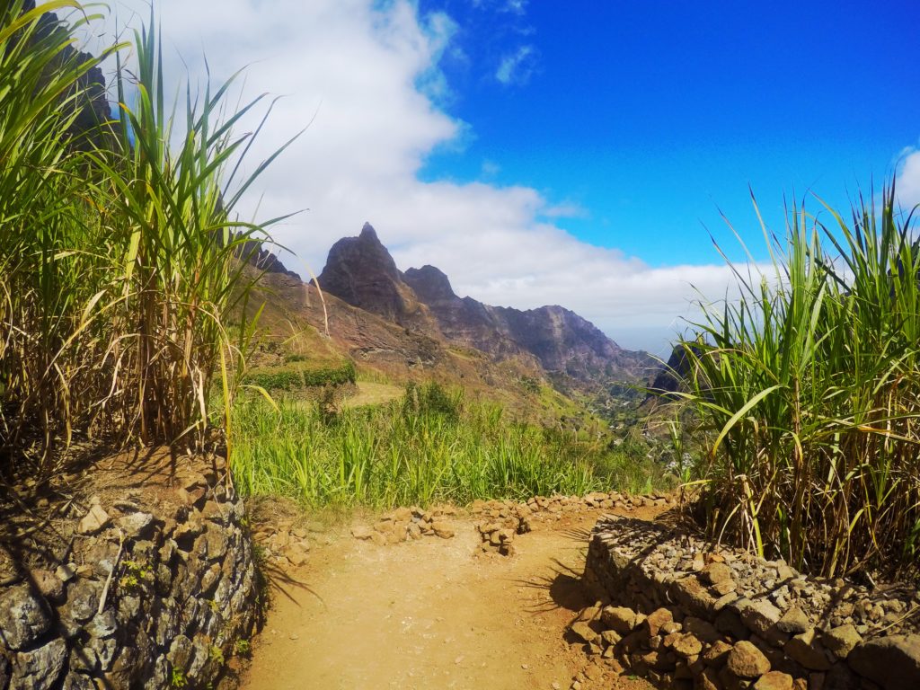
From here it’s only downhill.
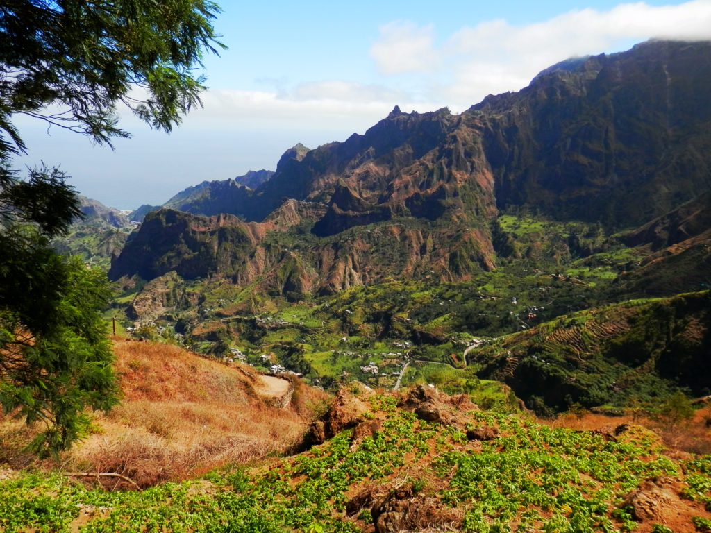
Beautiful scenery along the way.
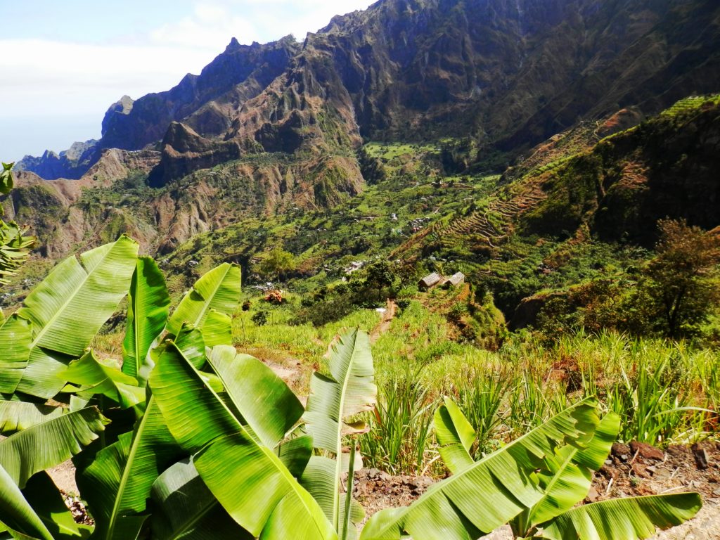
From here it’s only downhill which gets really tiring. I couldn’t feel my legs anymore at the end of the day! But the scenery was so worth the pain.
It’s difficult to imagine that people actually live here.
It’s so green here!
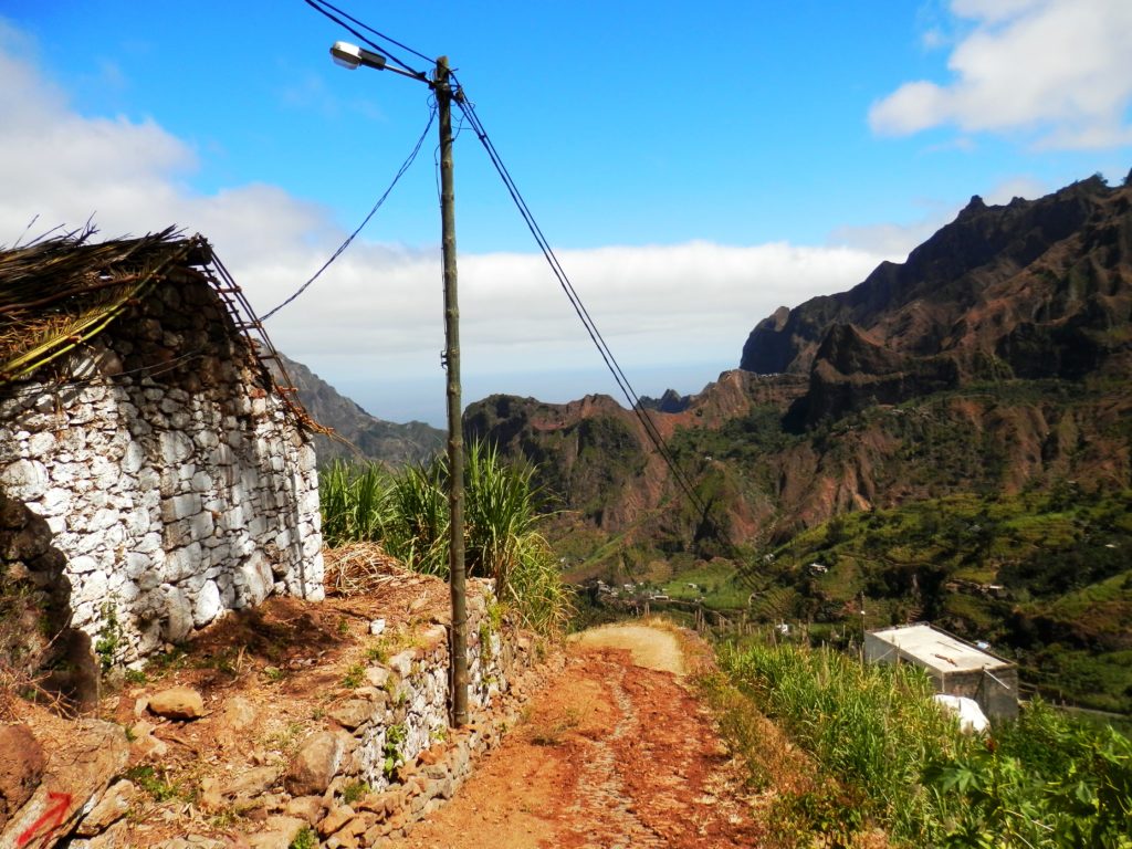
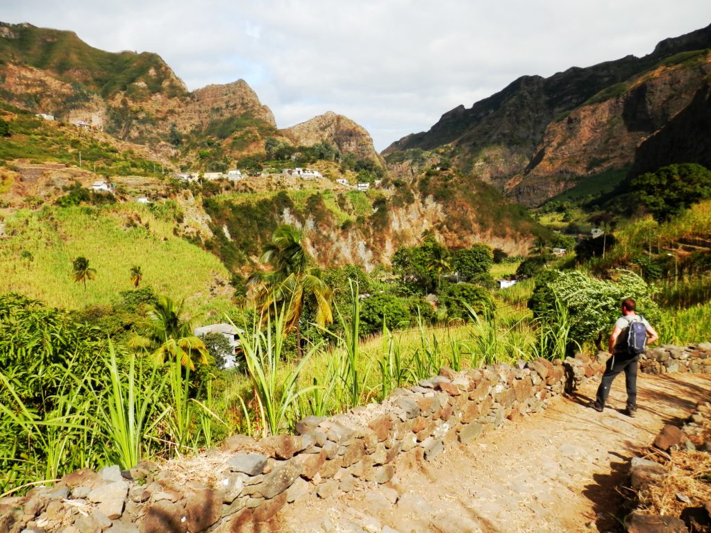
The steep downhill route passes through lush mountainside, verdant stands of bananas and fields of sugar cane. It’s difficult to imagine that people actually live and work here.
It’s a beautiful hike.
I love the scenery.
You will find a lot of rice fields along the way.
Halfway during the trail I met an awesome French guy with whom I continued the track towards the coastal village of Paúl. He works for a French television station and has been interviewing all the big names of Hollywood during the past 10 years. He had some great stories to share which helped me to forget about the pain in my legs.
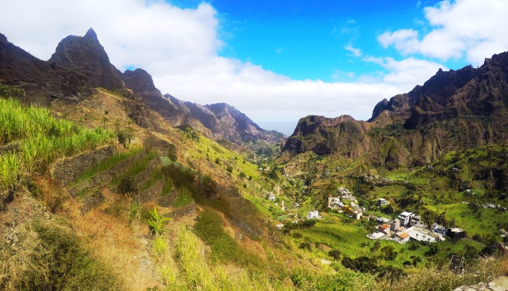
The Cova Crater – Valé do Paúl Track.
The Cova Crater – Valé do Paúl Track.
We’re reaching the end of the trail and all we can think of now is a nice cold beer. We deserved it! The entire trail takes roughly 5 hours.
The Cova Crater – Valé do Paúl Track.
We reached the road towards Paúl!
After a few well deserved beers I walked along the waterfront towards my hotel. I stayed at Black Mamba which I can highly recommend. The location is just perfect. The owners are Italian and super friendly. Oh and they also make some really tasty pizza’s!
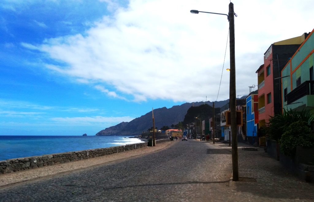
The coastal road in front of Black Mamba.
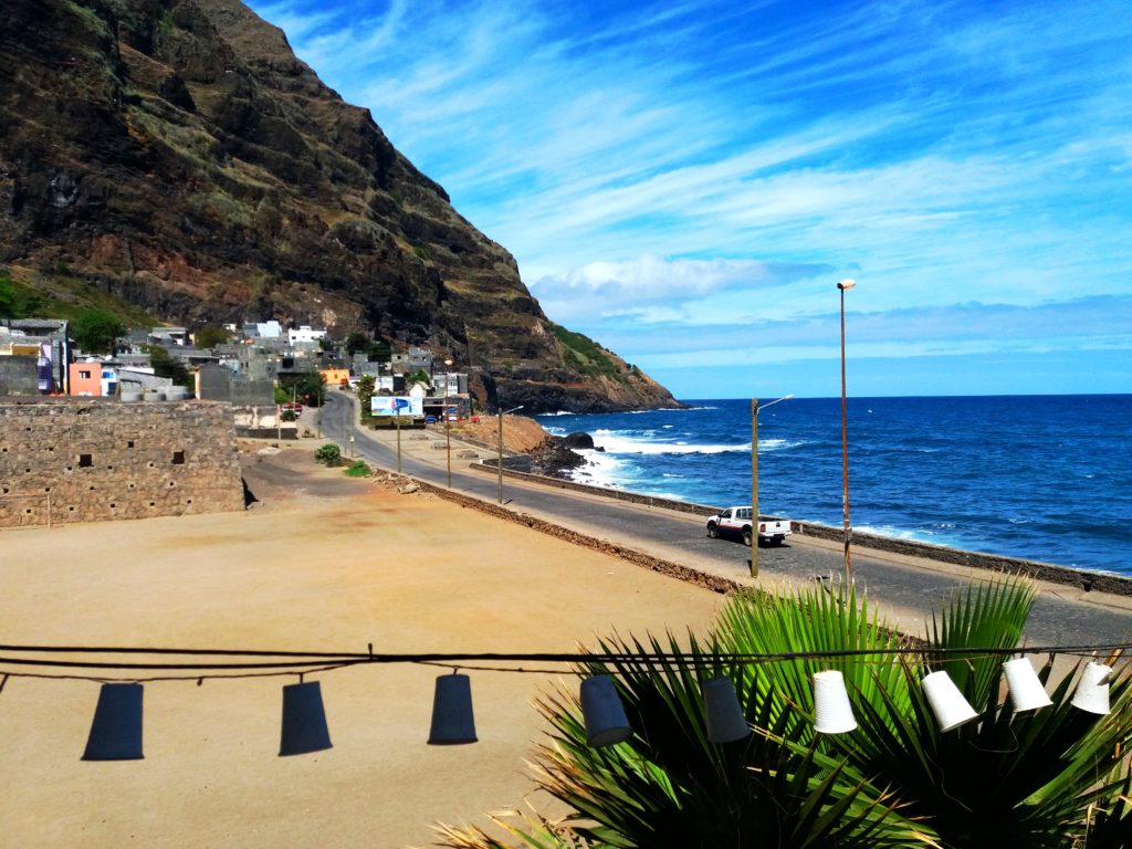
The view during my breakfast at Black Mamba.
My room felt like a tree house. I had to climb a ladder through a hatch to reach my room which has 2 floors. The bathroom is located on the first floor and the bedroom on the second. From the bedroom you can see and hear the ocean. There’s no better way to wake up than with the sound of the ocean. Perfect!
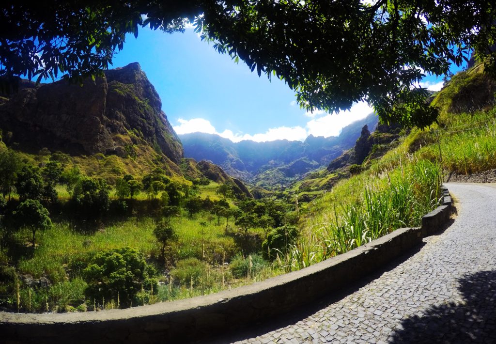
Coastal Track
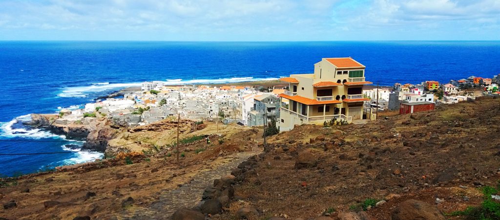
The second most popular track of the island is the coastal track. I took an aluguer from Paúl to Ponta do Sol from where I started the coastal track. The entire coastal track takes roughly 5 hours. I chose to only hike the section from Ponta do Sol to the village of Fontainhas which takes 1,5 hours.
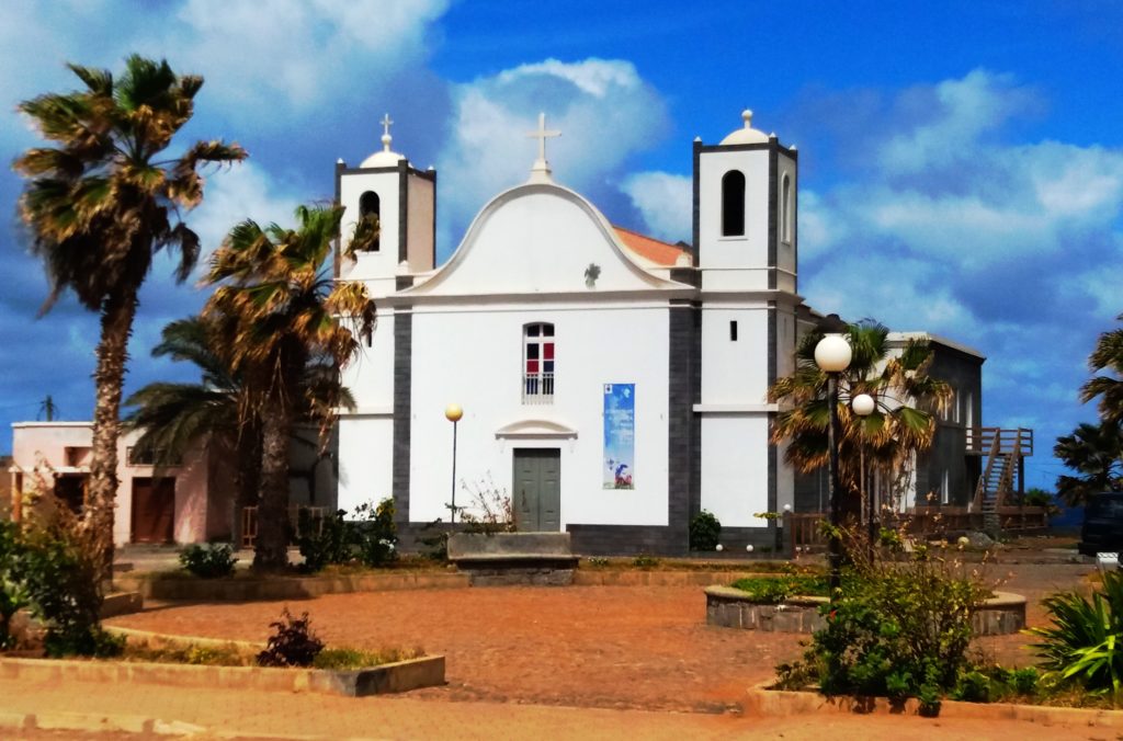
The church of Ponta do Sol.
The hike starts uphill with a great view over Ponta do Sol.
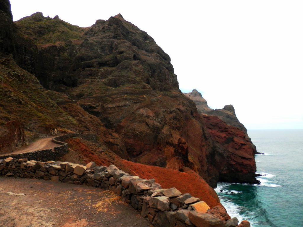
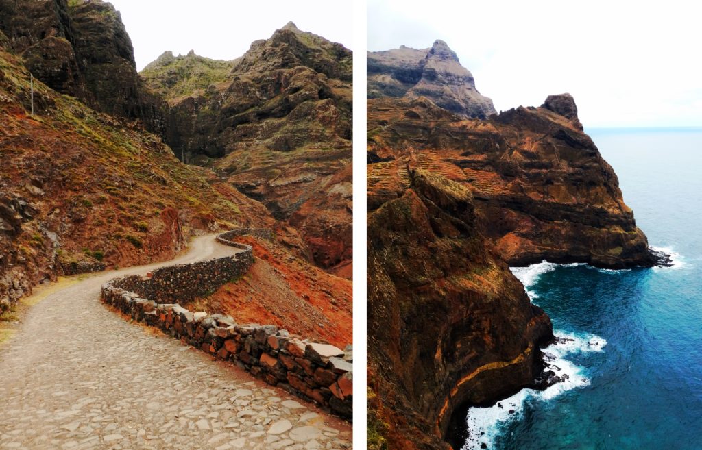
The coastal track takes you along a narrow path carved out of the cliff face. Some parts of the track are pretty high and steep.
The coastal track from Ponta do Sol to Fontainhas.
The coastal track from Ponta do Sol to Fontainhas.
Stunning views along the way.
The coastal track is pretty easy compared to the Cova Crater to Valé do Paúl Trail from yesterday. The path is pretty well maintained and paved with cobblestones.
Rugged rocky shores.
The coastal track from Ponta do Sol to Fontainhas.
The coastal track from Ponta do Sol to Fontainhas.
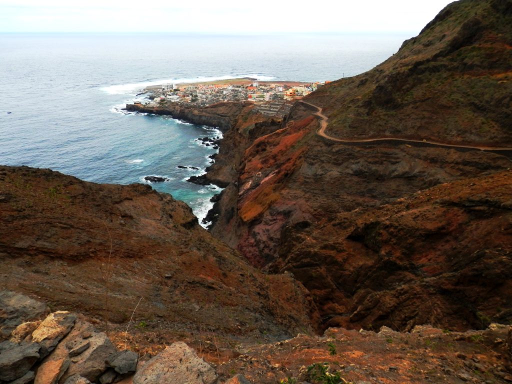
The path leads you pretty close to the edge and seeing the huge crashing waves lapping the rocky shores below is just spectacular.
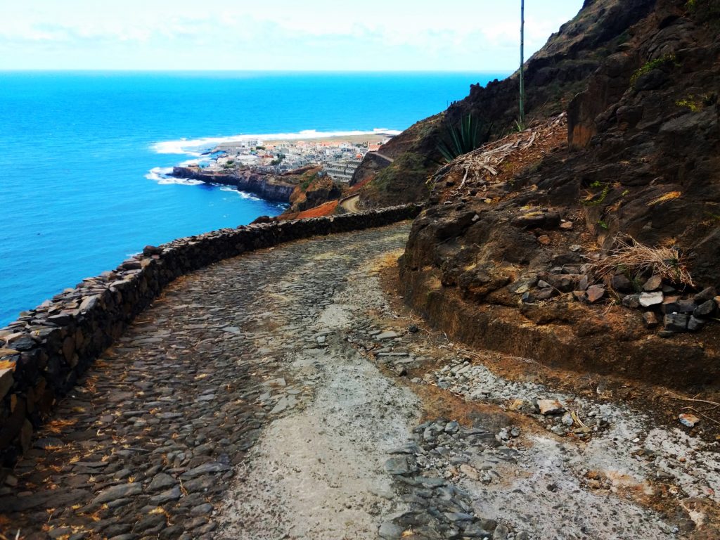
The majority of the path is paved with cobblestones.
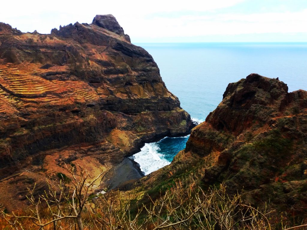
Stunning rocky shoreline.
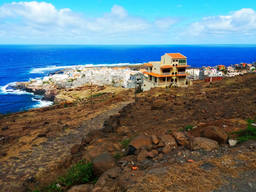
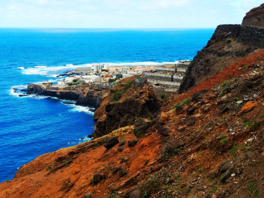
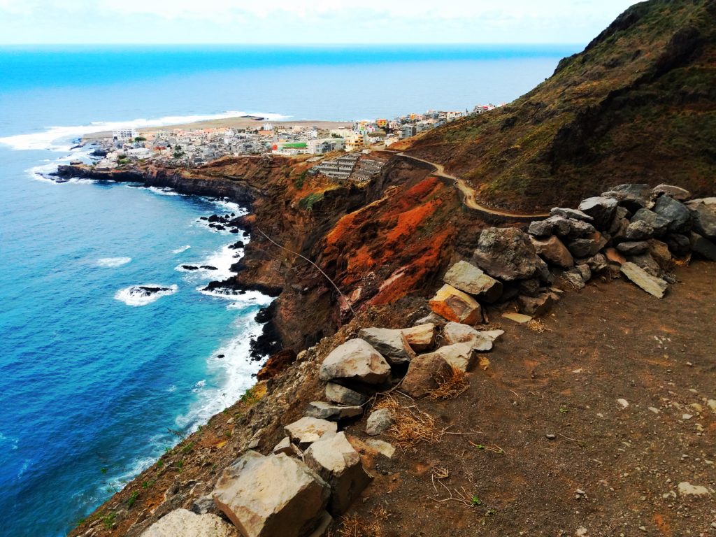
After an hour you will see the village of Fontainhas ‘hanging’ to a little ridge high above its fertile valley and a small rocky cove. After a quick lunch in Fontainhas I made my way back to Paúl.
The village of Fontainhas.
The stunning island of Santo Antão is spectacular and for me the highlight of Cape Verde. If you like hiking then I highly recommend to pay a visit to this gem in the Atlantic ocean.
Wanna see more travel pics? Check out my Photo Gallery


I am going to be on the island for a whole week in Dec-Jan. Really greatful for all the info here. Do you know where else I can get info about different walks on the island?
Hi Sasan, thanks for your comment! It’s quite hard to find info about the walks on the net. I would recommend to buy a hiking map of the island when you get to Santo Antao. If you prefer a guided walk then you can contact Davy here: http://walksantoantao.com/ Enjoy your trip!
Thanks for your recommendation
Hello Patrick !
Your pics are amazing, we are going to Santo Antao in November and we can’t wait to walk in your foot prints ! 🙂
Where did you find a hiking map on the Island ? Is there a tourism information center in Porto Novo ?
Regards !
B & J
Hi B & J,
Thanks a lot for your comment! Most people arrange their hiking trips with a guide from Mindelo. Or you can arrange your guide in advance who will then be waiting for you at the ferry terminal in Porto Novo. You can also take a minivan from the ferry terminal to Paul which is quite a nice little town. From Paul you can arrange hiking trips; any hotel or hostel will help you with a map, guide or other information.
You can find more information here as well: http://www.mindelocaboverde.com/santo-antao
Enjoy your trip!
Hello there– Where would you recommend to stay in Santo Antão for someone interested in hiking, but has only about four days to do around? I consider that it is best to choose one place to stay during the time and hike from it and back everyday (probably with some public transportation assistance from/to, etc’)? Would you agree with that? How about Ribeira Grande as such a base in the area? Thank you.
Hi Uri,
Thanks for your comment! I would recommend to stay in 1 place during your visit, both Ribeira Grande and Paul are great places to base yourself for a couple of days. You can travel by aluguere (shared minivan) to and from your hiking trail. Just tell the driver which trail you wanna go to.
Enjoy your trip!